Nature-based solutions for Lauwersmeer dike reinforcement
The initial plan proposed by Rijkswaterstaat (Dutch national water authority) was to raise existing flood defences of the Lauwers Sea. Local stakeholders, mainly aiming at improving agricultural conditions, demonstrated against this plan. Therefore, the government chose to create a freshwater lake, the Lauwersmeer by constructing the Lauwersmeer dam.
From Lauwers sea to Lauwers lake
In the subsequent decades, awareness of the importance of estuarine systems grew. The Wadden Sea is now an UNESCO World Heritage site and is considered to be a nature area of global importance, which is protected by European legislation, such as the Birds and Habitats Directives forming the Natura2000 network and the Water Framework Directive. Existing dikes and dams along the Wadden Sea form a barrier for many species, and the nature values of the Wadden Sea are, therefore, contained within that area.
The challenge
Due to increased flood safety standards, sea level rise and end o f lifetime of materials, the Lauwersmeer dam requires revision. During the preparation for this revision, other opportunities than raising existing flood defences, were explored. The demand to enhance the border of the Wadden Sea in a more natural way is shared by all stakeholders (Dutch Water Board Noorderzijlvest, province of Groningen, Rijkswaterstaat & municipality Het Hogeland). We were asked to find solutions which enhanced the border of the Wadden Sea, whilst fulfilling flood protection requirements.
The solution
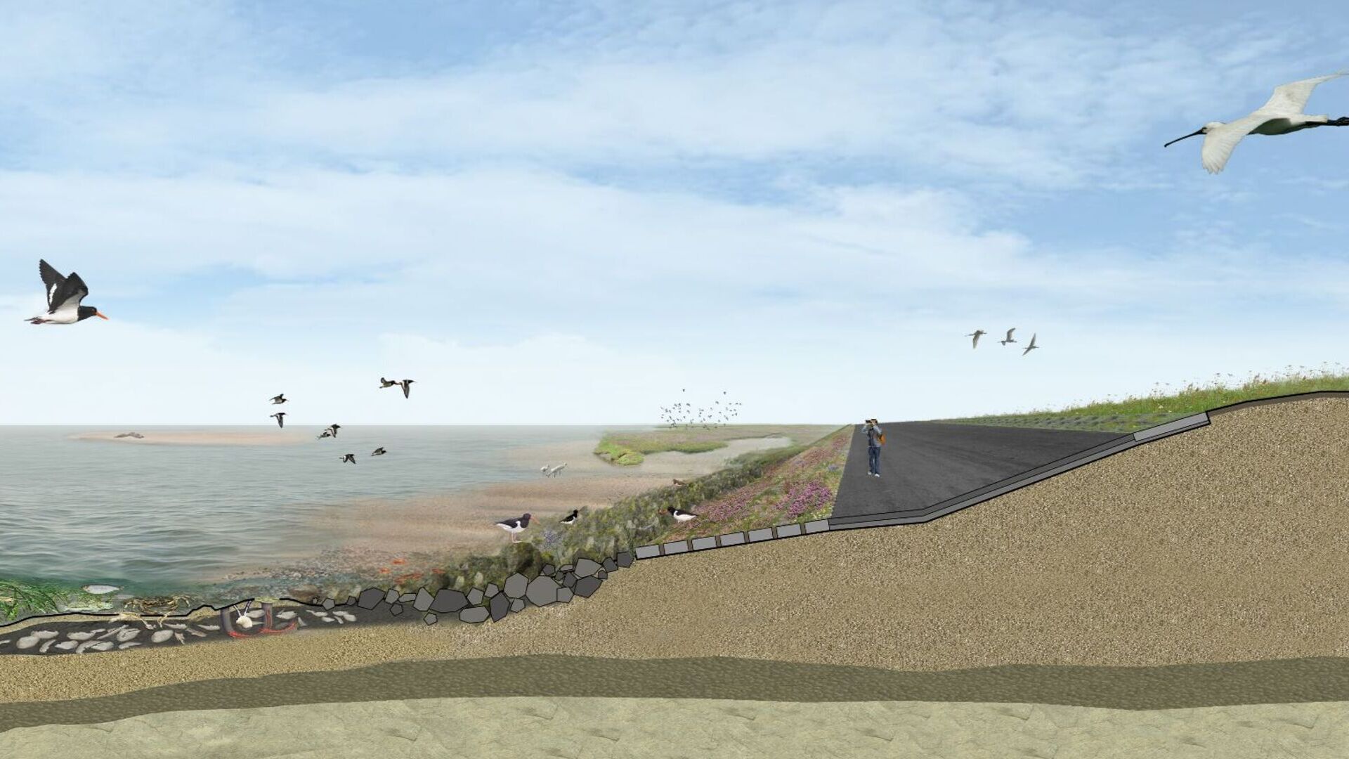
The solution was found by investigating and understanding the morphology and ecology of the Wadden Sea along the Lauwersdam. At the west, where a deep channel is located near the Lauwersmeer dam, a ‘rich’ dike concept is chosen, which provides a natural transition between sea and land. Below water, materials are proposed which allow cavities for sheltering crabs, lobsters and fish and provide substrate for benthos. In the tidal zone, substrate for shellfish is added, which provides food for ruddy turnstone, Eurasian oystercatcher and common sandpipers. Near the crest of the dam, roughness elements, such as rings, are recommended to limit overtopping during extreme conditions, but also to allow upper marsh vegetation species settlement. Furthermore, a flowery grass type is proposed.
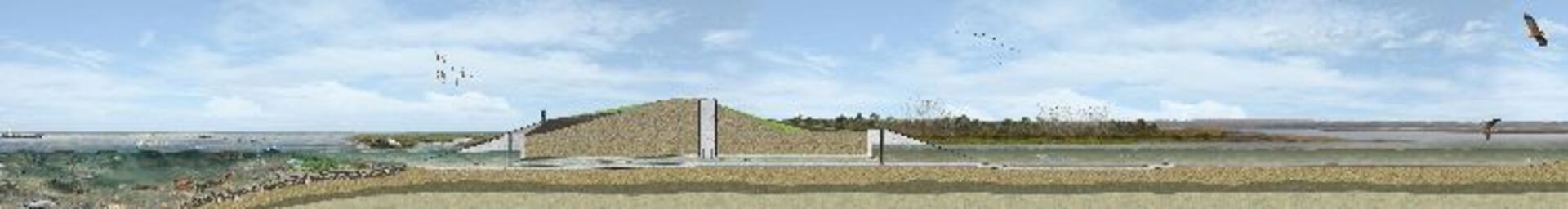
At the east, salt marsh development is stimulated by the realization of sheets of wooden piles. This ensures that the highest parts of the intertidal area become overgrown with plant species that can live in a saline environment and with shellfish beds. Furthermore, there is more habitat for pioneer salt marsh species, which will increase the biodiversity of the salt marsh.
In between, an existing brackish lake is connected to the Wadden Sea by a culvert. At the other end the brackish lake is tied into the inland water system. Subsequently, a fish migration route with a gradual transition from salt to freshwater is created. Furthermore, the brackish lake acts as a shelter for juvenile fish.
The result
The client (Water Board Noorderzijlvest) and stakeholders were satisfied with our proposed solutions. As a result, government funding was received for realising these solutions. The client is now preparing for the realisation of the project which is expected to take place in 2023.Want to know moreor got a question?
Contact our Climate Resilience experts!